Aerial Thermography, From the Sky Down
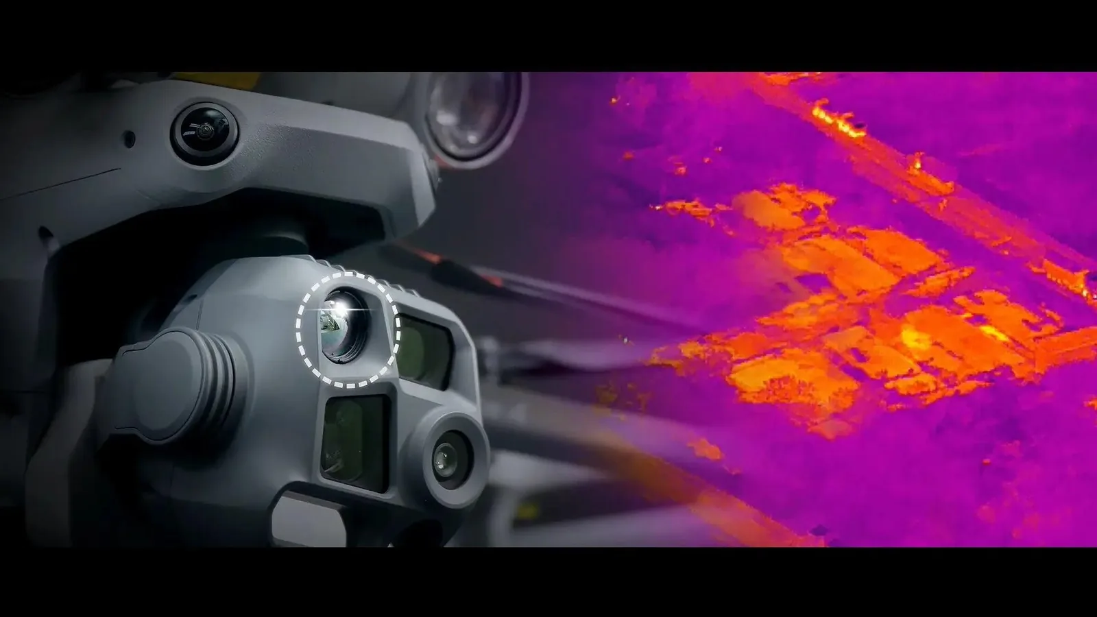
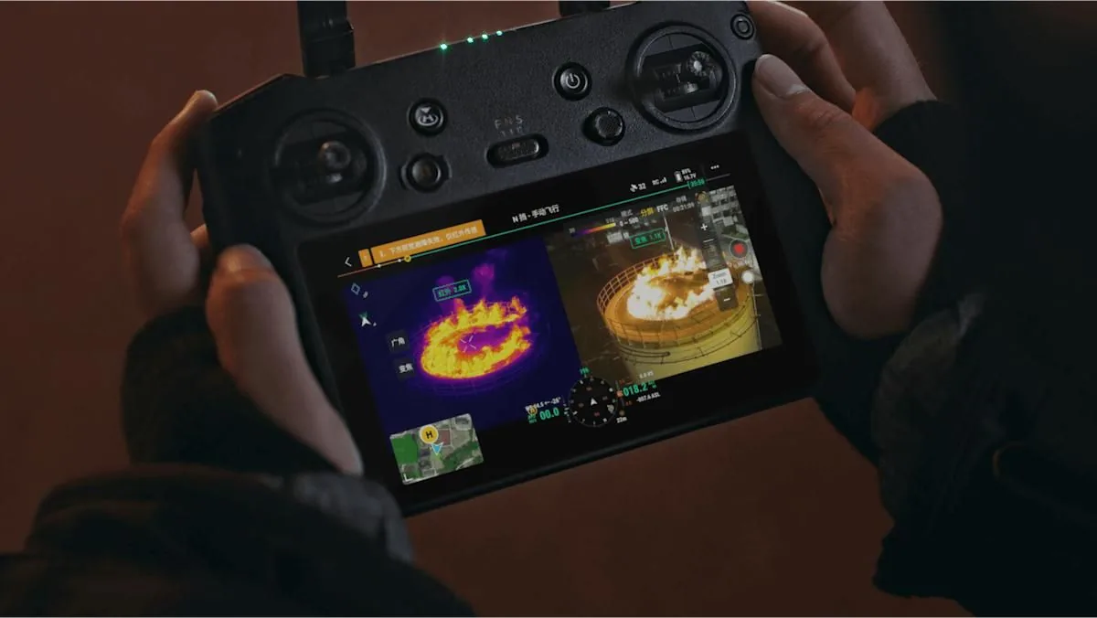
Thermal imaging lets us see what the human eye can't — heat. Mounted on our drones, high-resolution thermal sensors detect temperature differences invisible from the ground, helping us locate energy loss in buildings, failing cells in solar arrays, stragglers in a herd at dusk, or a lost pet hiding in thick brush at night.
Whether you need a one-time professional inspection or help finding something (or someone) important, we bring the same commercial-grade equipment and flight experience to every job.
PROFESSIONAL SERVICES
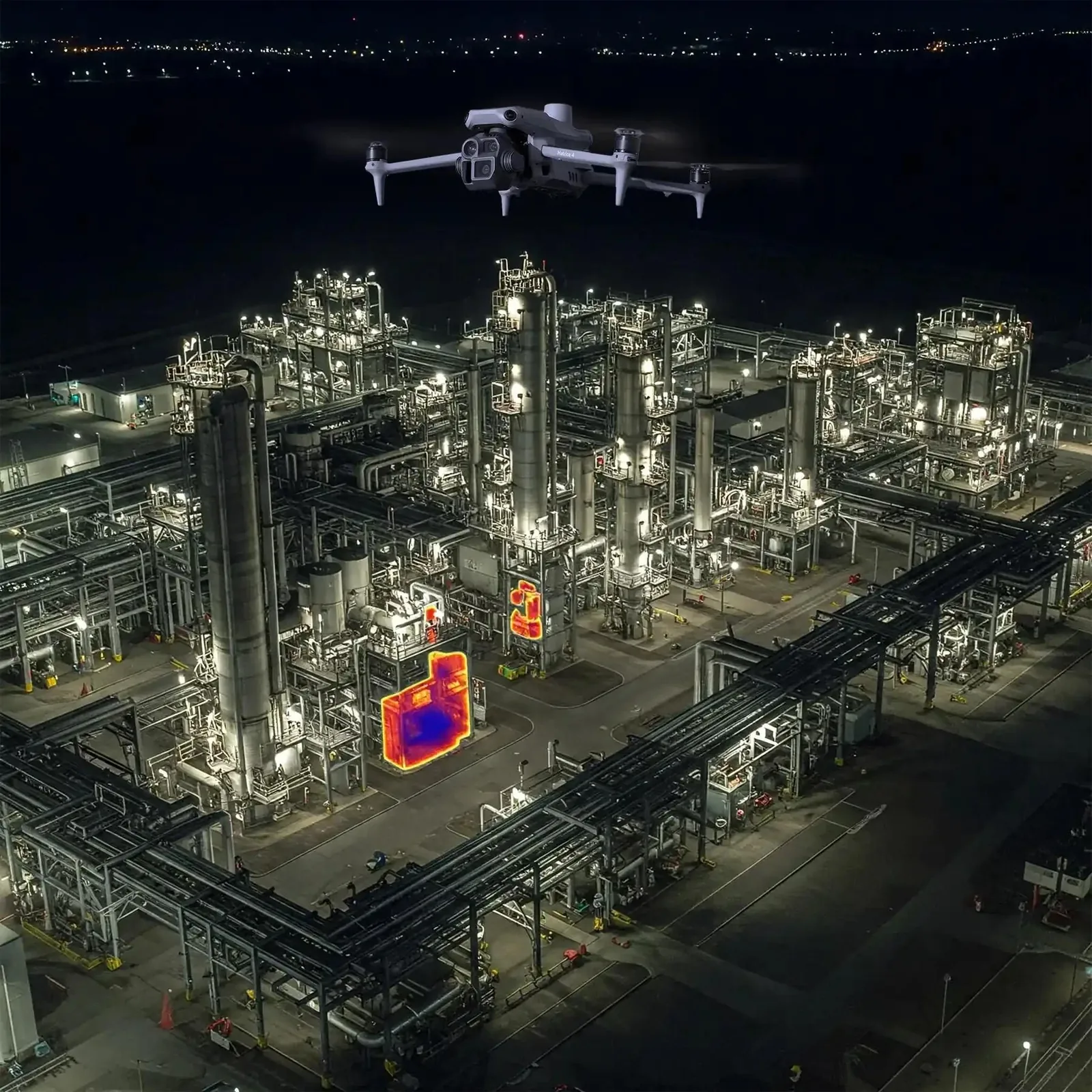
Commercial & Industrial Inspections
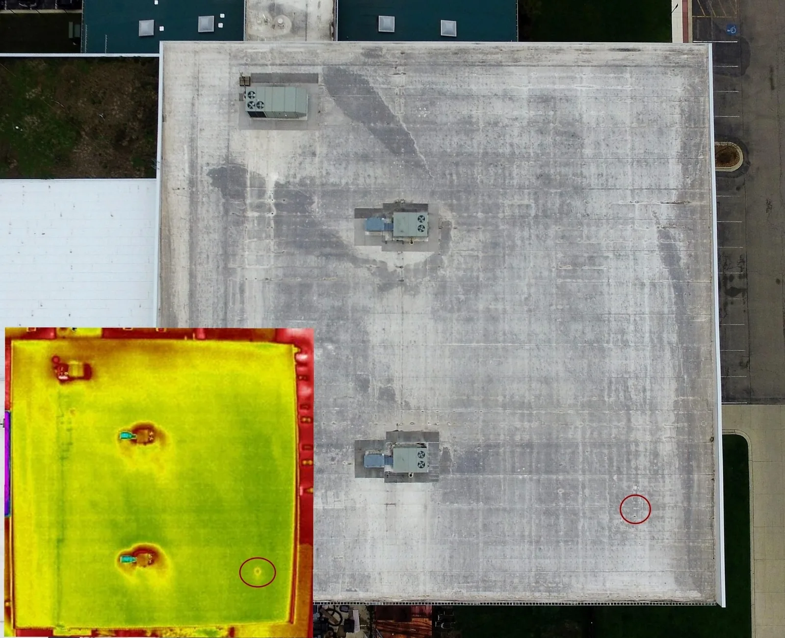
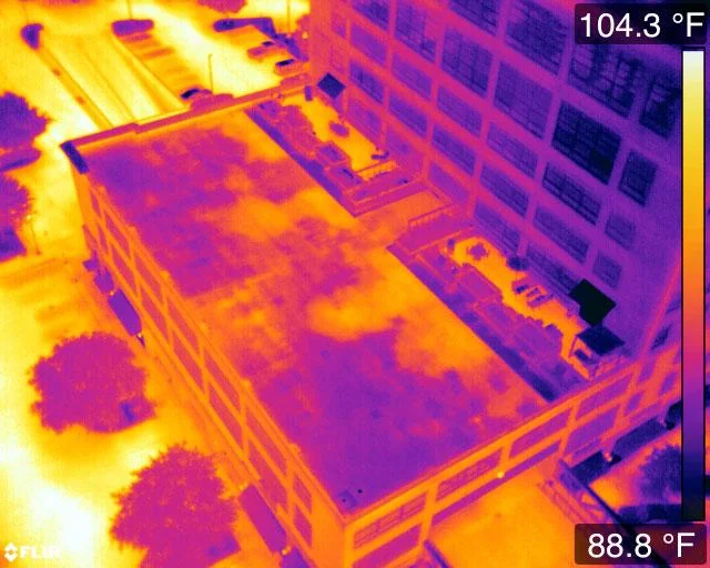
Roof & Building Inspections
Thermal drone scans reveal moisture intrusion, insulation gaps, and heat loss long before they become visible damage. We produce detailed reports for commercial property owners, facilities managers, roofers, and home inspectors — covering flat roofs, large industrial buildings, and multi-building sites in a fraction of the time a ground inspection would take.
Because thermal imaging is non-contact and non-invasive, there's no walking the roof, no tear-outs, and no disruption to occupants or operations.
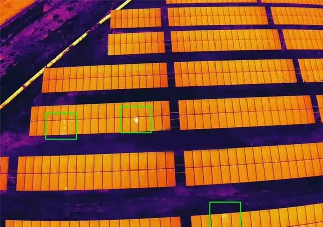
Solar Panel Inspections
A single failing cell can drag down the performance of an entire string. Thermal imaging from the air quickly identifies hot spots, bypassed diodes, micro-cracks, and failing connections across residential, commercial, and utility-scale solar installations.
Early detection means more power generated, fewer surprises at maintenance time, and clear documentation for warranty claims.
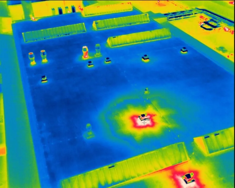
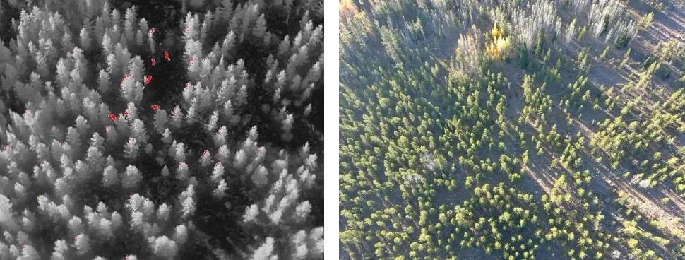
Livestock & Herd Monitoring
Large pastures, wooded lots, and nighttime checks are where thermal shines. We can count cattle, locate stragglers, identify sick or injured animals by their heat signature, and cover ground fast — without stressing the herd or requiring anyone on an ATV after dark.
A great fit for farms managing rotational grazing, calving season, or just wanting a quicker way to do a nighttime headcount.
COMMUNITY SERVICES
Search & Rescue
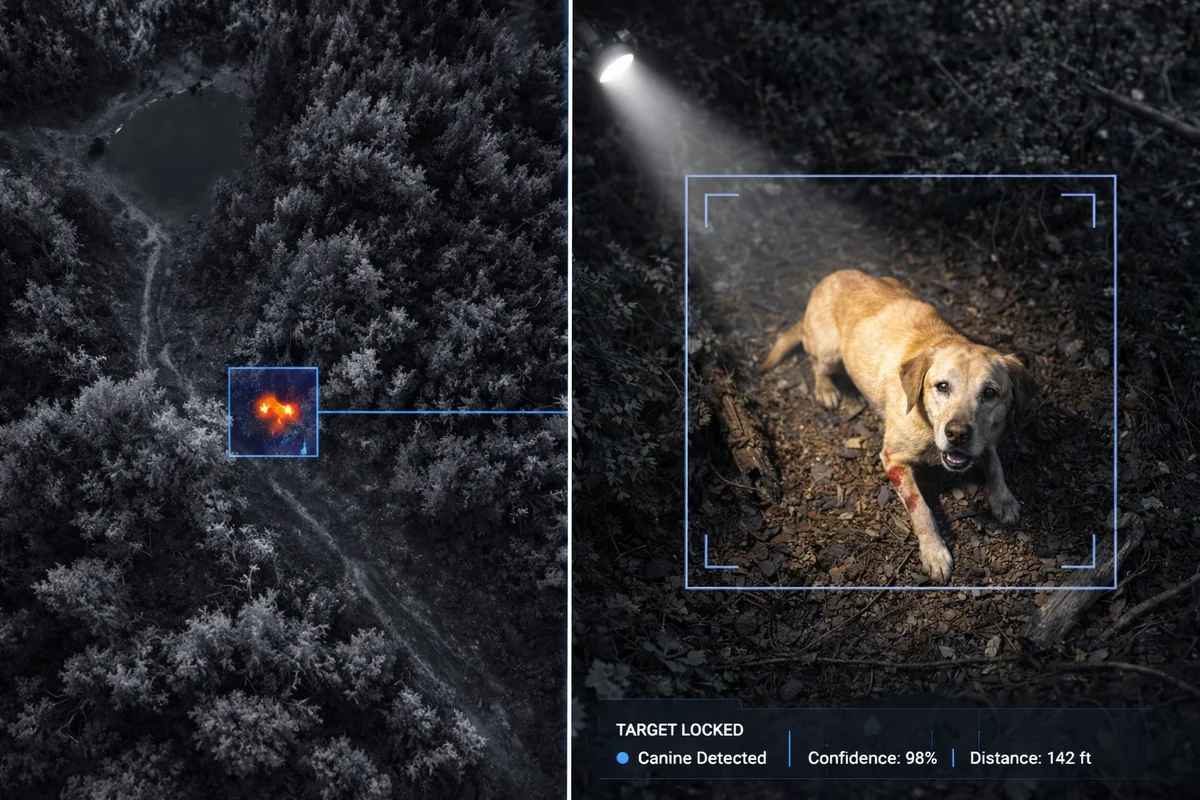
Lost Pets & Lost Cattle
If a dog, cat, or head of cattle has gone missing, thermal drone imagery can be the difference between finding them and not. A warm body gives off a heat signature that stands out clearly against dense woods, tall grass, corn fields, or the cold ground at night — places where you could walk right past and never see them.
We fly low, systematic grid searches, coordinate with you on the ground, and can cover many acres in the time it would take a search party to cover a few. It's become a more common and increasingly popular use of thermal drones across the country, and we're glad to offer it locally.
A Note on Pricing & Service Area
We try to keep search & rescue flights as affordable as we reasonably can — this isn't meant to be a profit center for us, but we do need to cover our operating expenses (fuel, equipment, pilot time, and travel) at a minimum to keep offering it.
Most of our search & rescue work is centered on Oneida County, Herkimer County, and the greater Syracuse area, where we can respond quickly and keep costs low.
That said — we travel all over New York State for our other work, so for jobs outside our immediate area we're happy to take them on a case-by-case basis. Reach out with your location and situation, and we'll let you know what's workable.