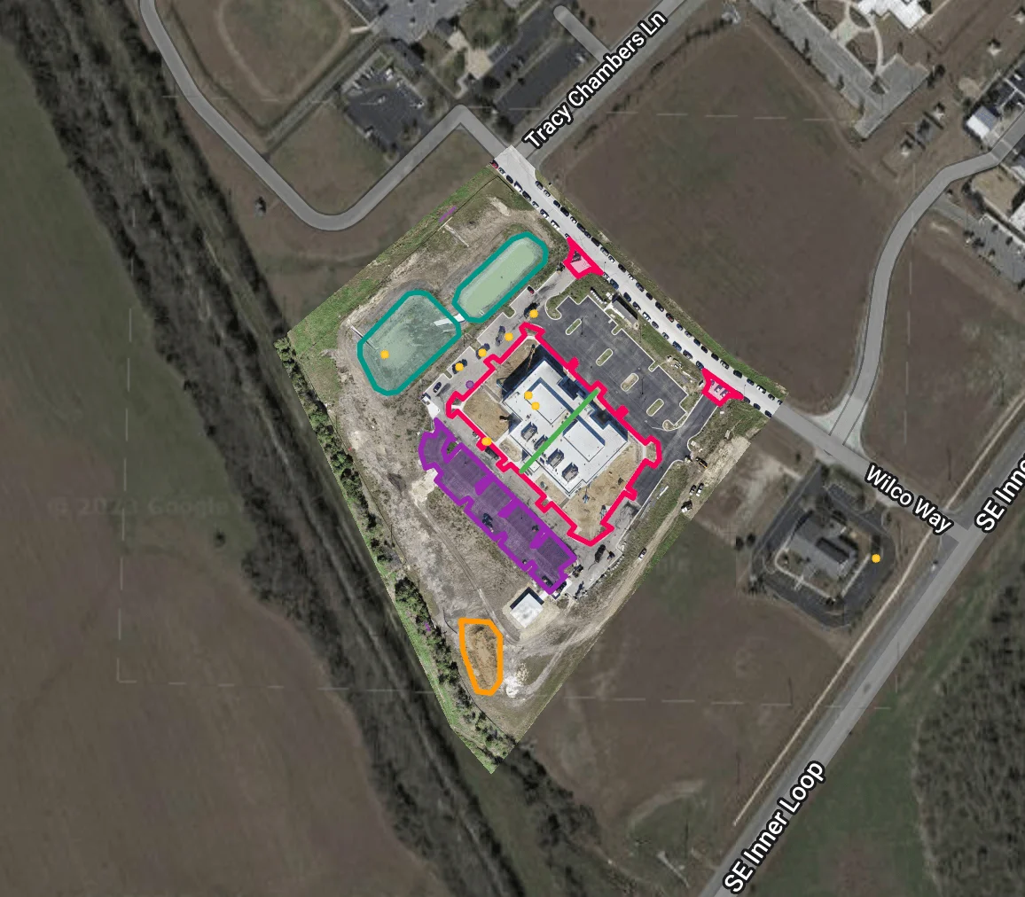
Mapping and 3D Models
Mapping and 3D modeling are crucial for a variety of industries, offering valuable insights and precise measurements. Accurate mapping enables efficient land management, urban planning, and environmental monitoring, while 3D modeling provides realistic visualizations and aids in infrastructure development. At CNY Drone Services, we provide superior mapping and 3D modeling services using our advanced drone technology. Our drones capture high-resolution aerial imagery and employ cutting-edge software to generate detailed maps and models with unparalleled accuracy.
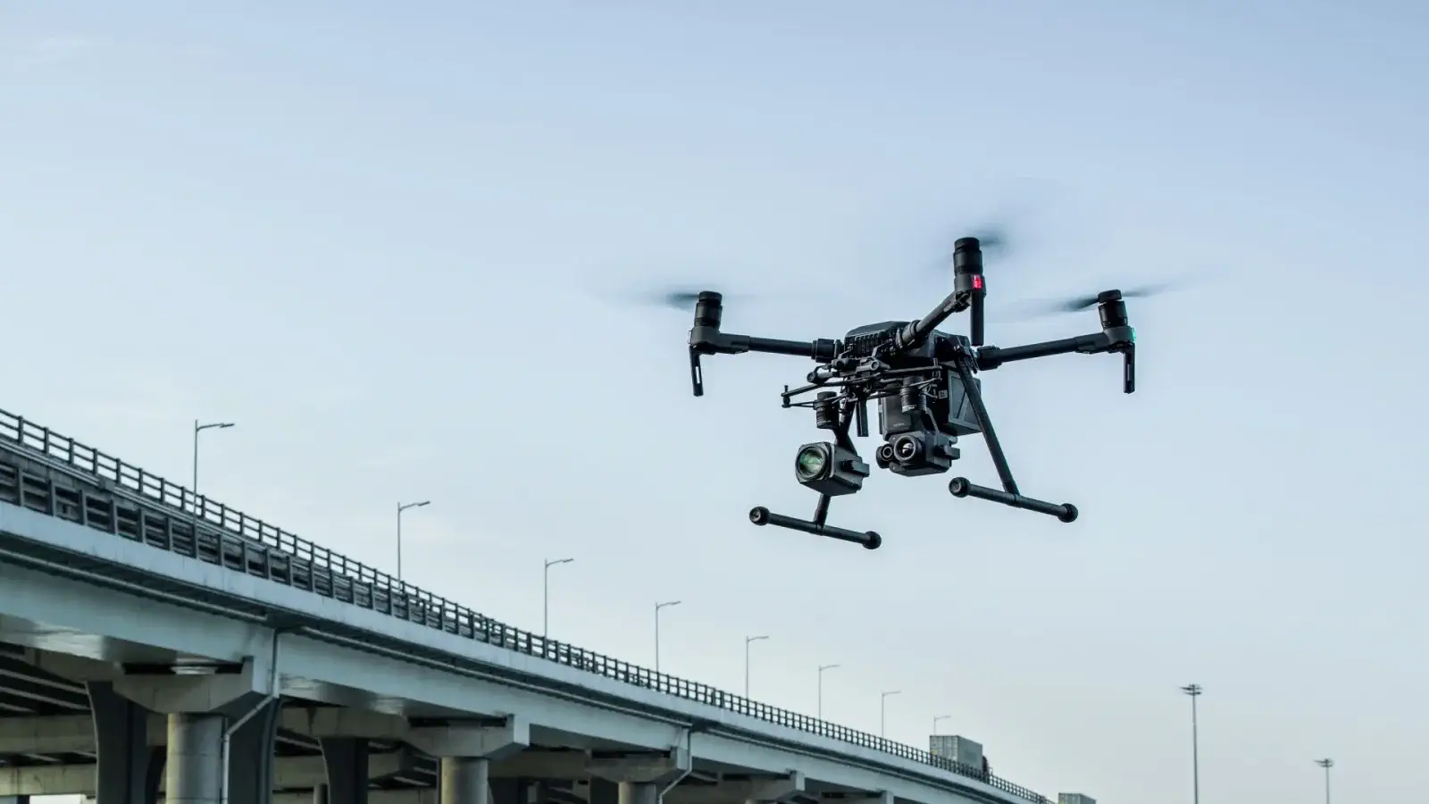
Tower, Bridge, and Building Inspections
Our drone inspection services enable access to hard-to-reach areas while reducing the need for scaffolding or manual inspections. These inspections help identify potential risks, defects, or maintenance needs, minimizing the likelihood of accidents and costly repairs.